GVLiDAR
+ Online LiDAR datasets on-demand :
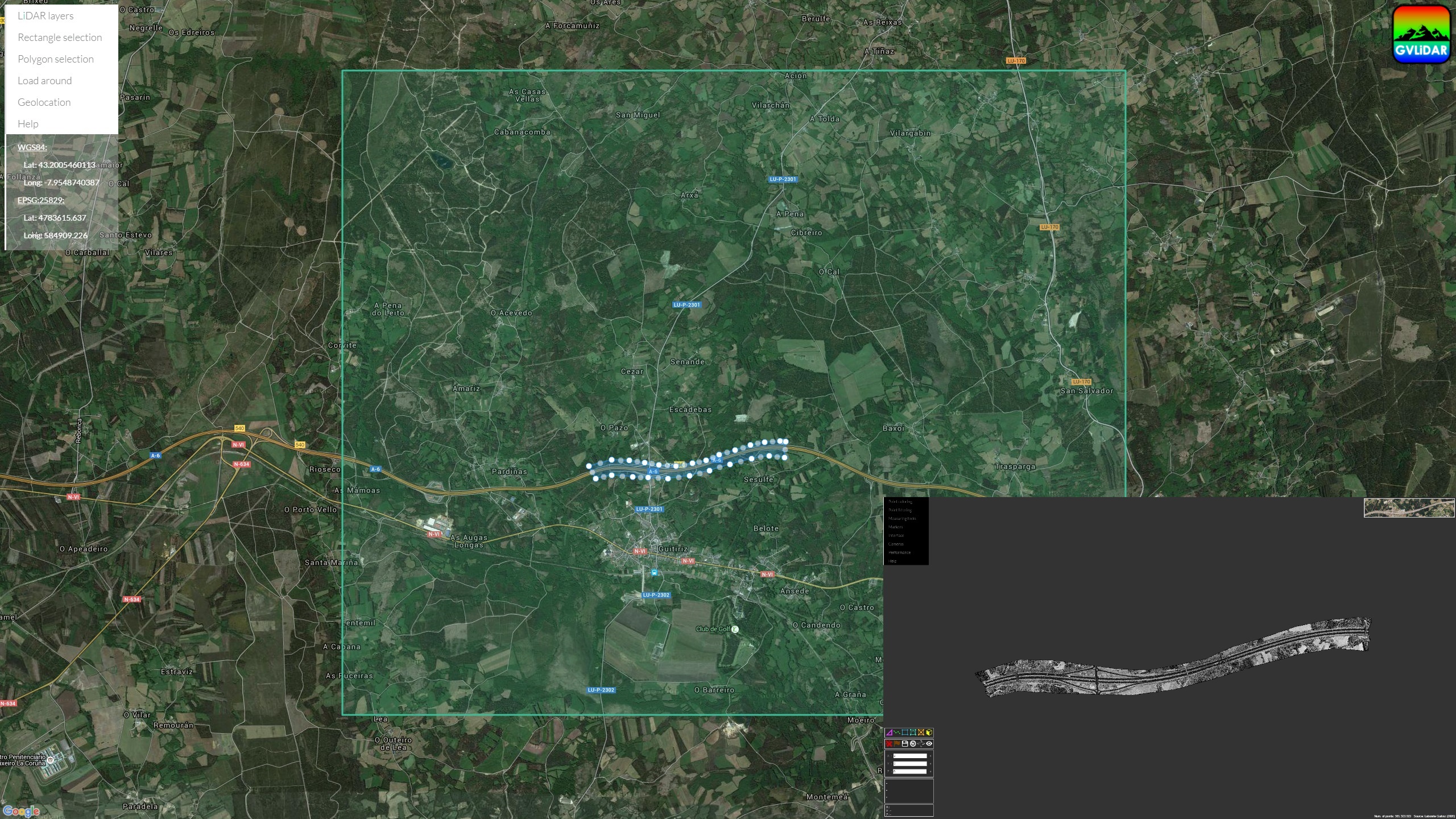
GVLiDAR offers to users multiple and ready-to-use LiDAR datasets stored on the cloud with the capability of performing complex data request based on spatial restrictions. You visualize just what you want to visualize.
+ Point-based rendering :
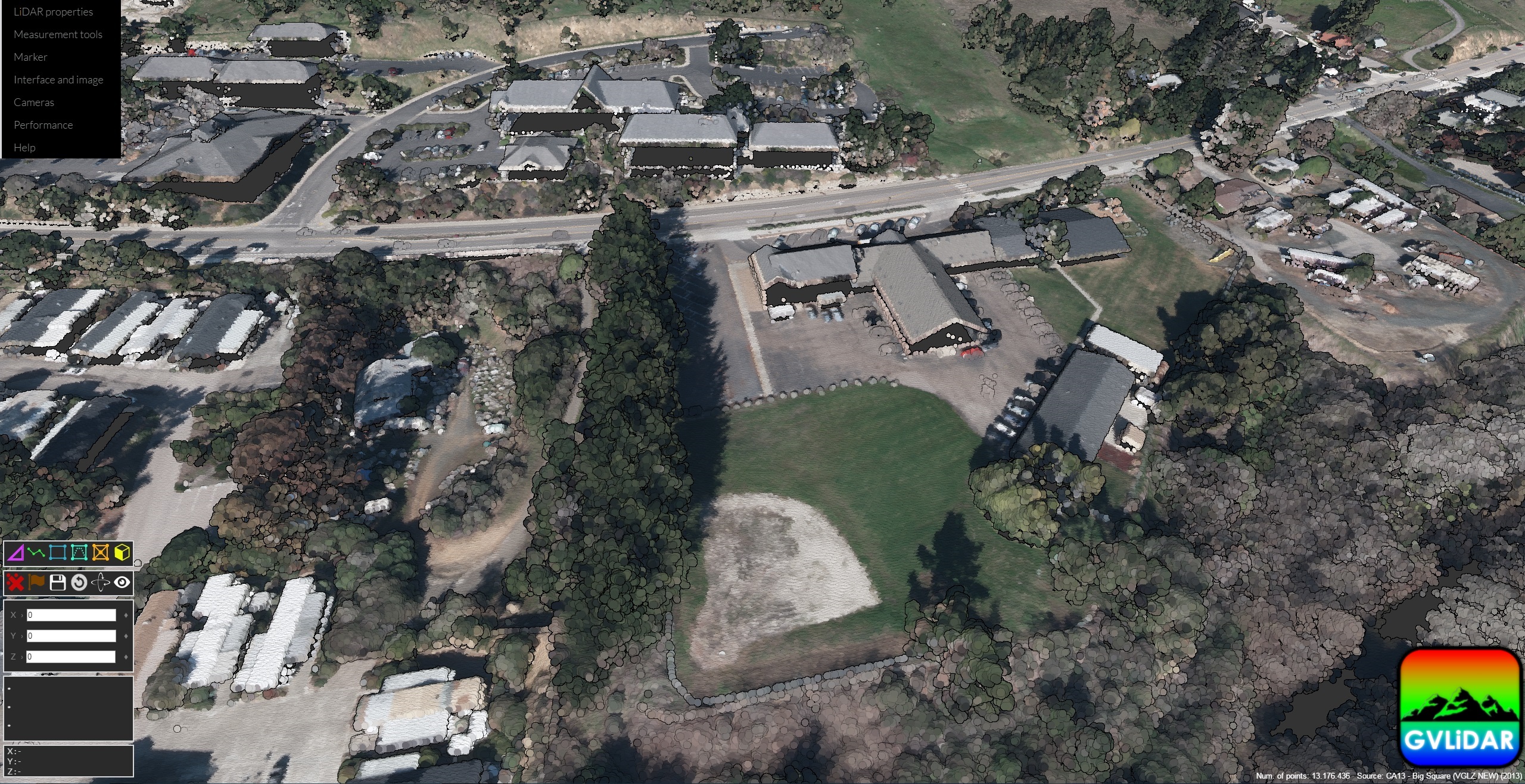
GVLiDAR implements techniques such as dynamic point size and eye-dome lighting in addition to optimization techniques in order to render realistic point clouds with several million points.
+ Geospatial measuring tools :
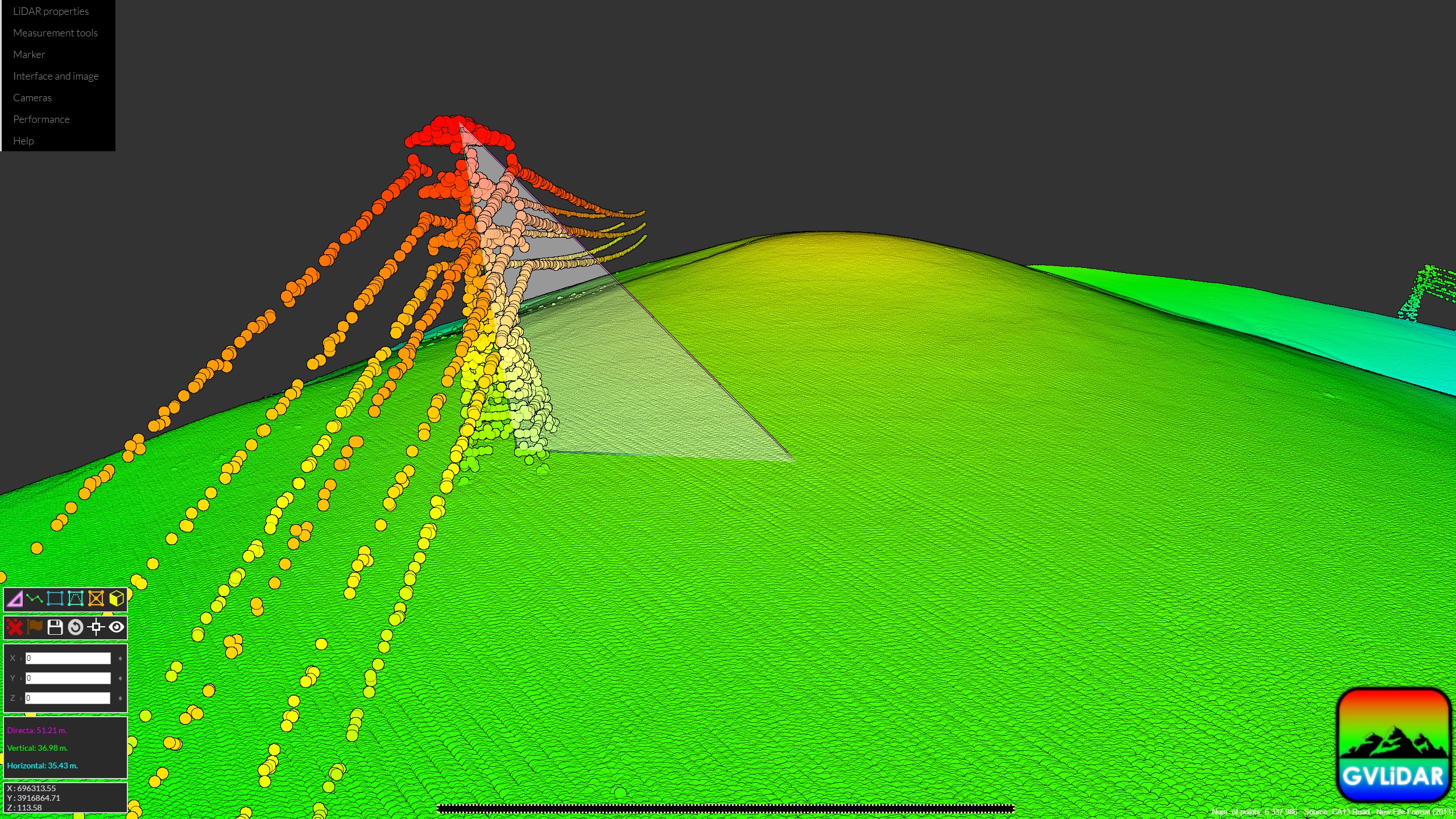
The design of GVLiDAR is focused on providing useful measurement tools. Users are able to obtain the height of structures, areas projected over any plane or triangulate points, among others.
+ Point filtering/rendering based on LiDAR properties :
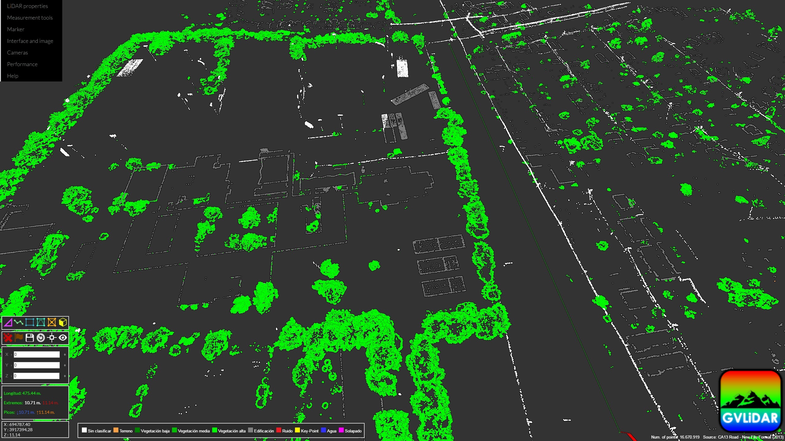
Point clouds can be filtered and rendered based on LiDAR properties. The image above shows the first returns of a neighborhood displaying also only the vegetation and the building classes.
